


Imagine entering the Arena and seeing only a few randomly scattered trees, buildings, rocks... that's it. Would battling in that environment be interesting for you? You bet it wouldn't! That's why our Maps Team strives to deliver unique settings and appealing visuals, all with close attention to detail.
We believe that the core components of an entertaining video game are not only gunfights and loads of action but also immersing you in an interactive, scenic environment. Such an approach, in our opinion, is going to elevate players' gaming experience. You'll have much more fun traversing the map: diverse zones with their own aesthetics, structures for taking cover behind or to destroy, and some spots that are just pleasing the eye.
The Mapping the World project is aimed at unraveling our team's pipeline (the process they follow) when it comes to map design. The following edition is dedicated to Maryland Heights and showcases its most eye-catching sights. A quick reminder though—it's still a work in progress, so remember that everything you see may be reworked in future.
Before setting out on a journey through Maryland Heights, we'll reveal the steps that our team follows to bring the idea of any map to life.
At the earliest stage, our level designers, together with concept artists, generate an idea for the future map and choose a unique natural biome for it (a specific environment, selection of flora, etc.). Several variants are usually proposed, including possible thematic zones plus natural and man-made landmarks. After a heated debate, only one variant finally remains—the one that will deliver players an exceptional gaming experience and be different from any other map project.
The next phase is a laborious process of blocking, where our Level Design team begins to shape the terrain and position objects on it using basic templates. These are primitive low-poly 3D models with small numbers of faces, and they are used in a schematic initial variant of the map (i.e., its prototype). Once this step is complete, the map is ready for internal playtesting, where we test the gameplay and improve the navigation and balance sections of the map.
Early Maryland Heights prototypes
This is where art meets level design: concept and 3D artists work meticulously on map objects. As a result, the templates begin to take on a more refined and detailed form.
Now it's time for the Level Art Team to spring into action. They're the ones who turn the gameplay blocking into the map you're all going to fight on.
These are the milestones that lead to the birth of our maps in general. But there's more to the story—the game and team are constantly evolving! The game modes change, new characters appear, new technologies are applied, and more advanced tools are used in the development. All this leads to a gradual evolution of the map and often requires local changes.
Designing the environment is therefore a complex process involving many aspects and requiring the collective effort of several teams.
Now, let's return to Maryland Heights and learn what inspired our team when it was designed.
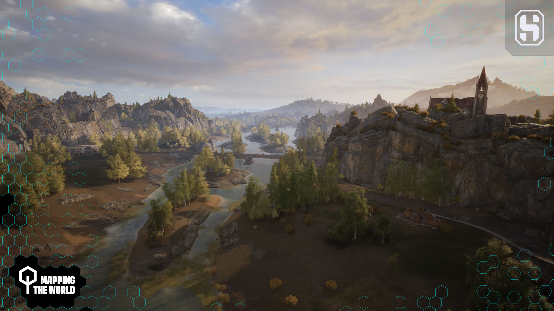
First, sit back, relax, and enjoy the scenery… When you see those rocky cliffs, vast farm fields, and neat houses in a tranquil rural setting, do any regions happen to come to your mind?
No surprise if some do! Indeed, there are real places that have left their mark on this map's terrain. The first one is Harpers Ferry—a small and peaceful town located in the mountains of West Virginia, USA. Its views are also deeply influenced by Charles Town of West Virginia and Frederick of Maryland. These spots encapsulate the atmosphere of days long gone with their precious historic sites, and they became the source of inspiration for our team.
Eventually, Maryland Heights ended up becoming a collage of different spots and inherited the typical Eastern American rural landscape.
Once you're in the game, cruise around the map and note the details here and there. These are subtle clues left by our team to evoke certain images in your mind. Notice the dilapidated buildings, boats left untouched on the shore, abandoned cars, no living creatures around... All of that adds to the desolate and post-apocalyptic atmosphere, indicating that the game is set in the future of the now uninhabited Earth.
This deserted, almost gloomy look of Maryland Heights' views is driven by its lore. This barren land's exterior hints about what happened to Earth's infrastructure and the human population when people had to leave the planet due to the inevitable catastrophe. They gave up their homeland for good, hence the drab atmosphere the Art Team instilled into the map's design elements.
This map was the first to be worked on. Needless to say, its creation and further development had its own specific elements and challenges to meet from the start.
It happened that the gameplay and game mode strategies "evolved" faster than the map's shape. As a result, some zones were developed under the demands of these two branches.
For example, one of the requirements was to create regions with objects that would fit the dimensions of our characters (e.g., objects that could provide cover for the tallest of them). This matter highly affected the choice of the map's visual components. Consequently, areas that were initially planned never saw the light of day.
You see, Hunters are supposed to be perceived by players as colossal battle machines that can crush and destroy everything in their path. This feeling of being unstoppable should be supported not only by sounds, effects, and the ability to smash things but also by the visuals. It's crucial for our team to show the power and scale of the characters, emphasizing the difference between their proportions and those of man-made objects. In this way, players are likely to assume that Hunters are far from anthropomorphic creatures—they are giant, mighty robots, capable of inflicting massive damage.
Matching the size of the characters to the outdoor environment is extremely important and often ties our team's hands when building maps. The setting of Maryland Heights needed to be adjusted to the appearance of Hunters so the dimensions of some objects would be exaggerated.
As the various characters have different dimensions, various modifications were made to the map's elements. For instance: wider passages, longer constructions for providing cover or other purposes, etc.—all so that the players could interact with no issues.
Another concern was the fact that Steel Hunters is a third-person game, where the camera is positioned above our Hunters' models and projected a little further away from them. This meant that objects had to be placed in such a way that the player could see them from a distance and move around comfortably.
As you can see, there are many rules and requirements that still affect the design of the map to this day, so much so that its content can be changed at any time.
One of the key terms of the Art Team's perspective of Maryland Heights is thematic zones. On the map above, we've marked some of them for you to explore. These spots are much more than just visual treats—they also help players orient themselves and navigate around the map. They also can stimulate different gameplay depending on the surroundings, whether there are a lot of destructible or non-destructible structures, for example.
Thematic zones and their objects are visible from a distance, allowing you to better position yourself and communicate with your Squadmates. To help you distinguish these spots easily, our team has made them unique. They differ in terms of their design and environmental aspects (e.g., their openness, height difference, proximity, remoteness, possibility of being shot through, etc.). These points therefore receive much more attention than any other locations, both from players and from the development team.
An old hydroelectric plant
Such areas usually contain special structures that stand out from the overall landscape and are designed to attract players' attention. For example, one such prominent object is a radio telescope—a truly fascinating sight near the town. Its appearance was taken from the Robert C. Byrd Green Bank Telescope (GBT) in Green Bank, West Virginia. It can be seen from afar and serves as a reference point for players.
During the design of the town area structures, our team drew inspiration from actual buildings. Let's take a look at some examples, but keep in mind that this area is still in a raw state and is undergoing rapid refinement.
Town hall building
Some of this zone's structures were patterned after the sights of Charles Town. These are: the town hall building (the Jefferson County Courthouse), school (Wright Denny Intermediate School), bank (Bank of Charles Town), and administration building (the Charles Washington Hall). In addition, smaller buildings' references (cafés, shops, etc.) were taken from real stores and restaurants in Charles Town.
The school, bank, and administration buildings
Shops and restaurants
Harpers Ferry was another source for building references. If you happened to visit this town, you might come across familiar spots in Maryland Heights. For instance, you'll definitely note the church building's elaborate design elements, which were inspired by St. Peter's Roman Catholic Church.
Additionally, the Harpers Ferry Post Office building exterior served as the basis of the police station's building model.
The church
Finally, some of the town's local landmarks were modeled using multiple references at once. E.g., the fire station is essentially a collage of different buildings—the McComb Fire Station and the Louisville Fire Department.
The police and fire stations
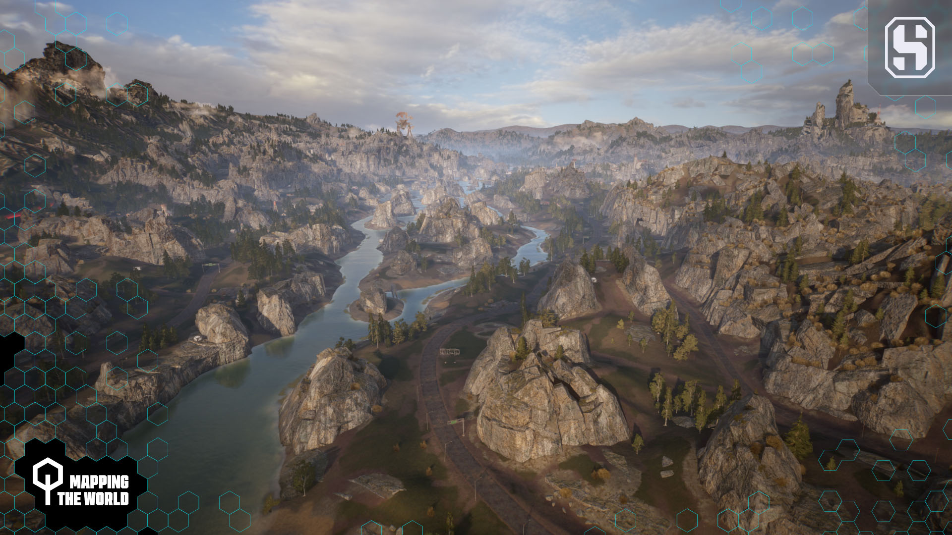
The vegetation of Maryland Heights was also influenced by West Virginia. Green valleys and streams cutting through steep mountain ranges are its "calling card." Such scenery is a boon for ecotourists, which is why eco parks are so popular in the USA. Camping areas, wooden plank bridges... such a refreshing atmosphere!
This signature American beauty couldn't be left out, so the team added hiking trails and a towpath along a picturesque riverbed to resemble an eco park.
To add more visual variety to the map, the team integrated rugged terrain and cliffs similar to Seneca Rocks.
As for the quarry zone, its main reference was the Carrara marble quarry, Italy. The team made its colors muted to fit the overall map's visual design and to prevent any issues with the user interface (if the UI was bright, it might interfere with the quarry's color scheme if the latter was whitish).
As we mentioned earlier, gameplay often dictates what objects and zones the map should contain. This resulted in our team manufacturing spots without any particular influences, as they were assembled to allow players to perform certain actions (jump on, take cover inside or outside the object, shoot from, etc.).
One such place is the construction site. The team came up with it to satisfy level design requirements—they needed a massive indestructible object in the industrial area. No references there, just creativity.
The early warehouse prototypes
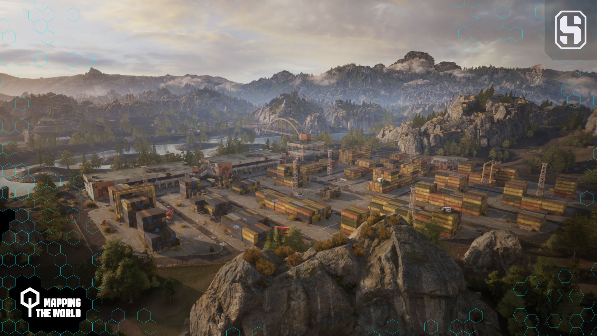
The warehouse area was also not inspired by a single location; it was made up of random cargo references. It's a two-level zone, which means that it involves vertical gameplay: there are climbable containers that divide players so they can interact with each other from different levels. This adds variety and makes player behavior less predictable.
While all the other areas usually have flat terrain in terms of gameplay and are more spacious, this one is the most interactive in Maryland Heights and the hottest in terms of battle. This is because it contains a densely stacked group of indestructible objects. You'll see what we mean when you compare it to the town area, for instance. Despite the fact that a lot of buildings seem to be crammed into one place, almost all of them can be destroyed, and you still can easily move in any direction while staying on the same level as your opponent.
Needless to say, this area brings playstyle versatility and diversity to the map's terrain.
As for the bridge leading to the town area, this was a complex object to work on. The Concept Team had to build it from scratch because there were certain requirements to meet.
For example, it couldn't be destructible, so the team was unable to use bricks or any breakable material. Plus, it had to have formidable height and pillars so players could take cover, gaps at the top so it could be jumped off, and so on. All these conditions, in turn, have an impact on the visuals, gunplay, and navigation.
So, it should be clear that objects in the game are usually constructed with regard to level design or particular gameplay purposes.
From ideas to concepts, from sketches to polished 3D models—every map has its own birth story.
Environmental design is an intricate process like any other stage of video game production. It has its own specifics, and we hope this article has helped you understand its basic steps.
So far, we've covered some of the Maryland Heights' sights, but there are so many more locations yet to be discovered! Hop into the game and take a trip to this forsaken land! Remember though, that the map is still a work in progress and will evolve with each patch. So, once you're there, it won't be long before you notice new things that our team has come up with!

